Every Project Tells a Story from Above.
From detailed site mapping and 3D modelling to cinematic promotional video, here's a selection of recent work across the North West. Take a look at what's possible when you get a different perspective.
Apartment Complex - Aerial Mapping & 3D Modelling
This project was captured as a demonstration of what drone-based photogrammetry can deliver for residential and commercial property.
Using the DJI Air 2S, we produced a full orthophoto with Google Maps overlay, a digital surface model, and a detailed 3D model of the complex — all processed in WebODM.
Whether you're a property developer, estate agent, or site manager, outputs like these give you an accurate, up-to-date aerial view that traditional photography simply can't match.

Orthophoto with Google Maps overlay

Surface Model with Google Maps overlay

Full 3D Model
Orthophoto with Google Maps overlay
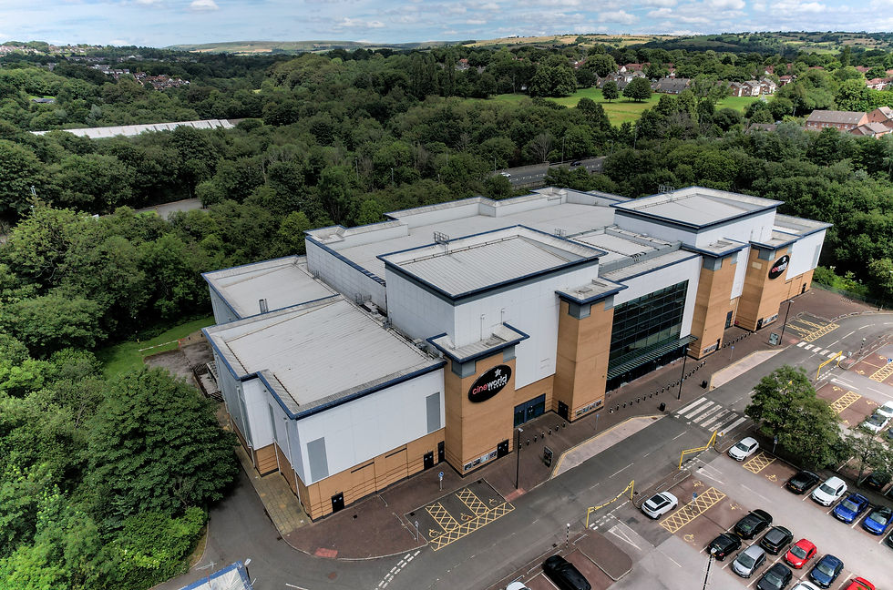
CineWorld - Map & Photo
This series of aerial images and orthophoto mapping showcases a detailed overview of a local cinema, captured using the DJI Air 2S on an overcast day for balanced lighting and accurate detail.
Shot from multiple elevations, the imagery highlights the full building footprint, roof structure and entrance. The orthophoto provides a precise, top-down view of the site, offering a true-to-scale perspective ideal for planning, documentation, and analysis.
Together, the aerial photography and orthomosaic deliver a complete visual record of the cinema and its surroundings — something ground-level photography cannot achieve. From spatial context to infrastructure layout, every detail is clearly presented in a clean, cohesive format suitable for both commercial and professional use.


Abandoned Factory - Industrial Site Documentation
Derelict and hard-to-access industrial sites present a real challenge for traditional survey methods. This project demonstrates how drone technology can safely capture detailed imagery of structures that would otherwise require expensive scaffolding or specialist access equipment.
Using the DJI Air 2S, we documented this abandoned factory from multiple angles, producing a comprehensive visual record of the site's current condition — rooflines, structural features, and surrounding land all captured in a single flight.
This kind of survey is ideal for property developers assessing a site before purchase, insurers documenting condition, or demolition contractors planning safe access.

Orthophoto with Google Maps overlay

no map overlay

Surface Model View with Google Maps overlay
Orthophoto with Google Maps overlay
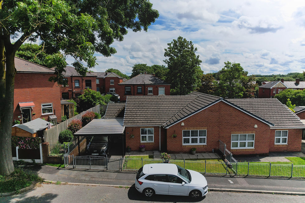
Aerial Property Photography - Residential Bungalow
This series of aerial images showcases a well-presented detached bungalow captured from multiple angles using the DJI Air 2S on a bright summer's day.
Shot from a range of elevations and perspectives, the images reveal every aspect of the property — the neat front garden with its flowering borders and covered carport, the roofline and overall footprint, the private rear garden, and the property's position within its wider residential street setting.
Together the shots give estate agents and prospective buyers a complete picture that ground-level photography simply can't provide — plot size, parking, outdoor space, and neighbourhood context all captured in one cohesive set.
Whether you're listing a property, marketing new developments, or simply want to present a home in its best light, aerial photography adds a dimension that makes listings stand out.


Promotional Golf Video - Aerial Course Flyover
There's no better way to showcase a golf course than from the air. This project captures the scale, layout, and beauty of the course in a way that ground-level photography simply can't replicate.
Using the DJI Air 2S, we flew a series of smooth aerial passes over multiple holes, combining sweeping flyovers with cinematic master shots that highlight the character and challenge of each hole.
Promotional video like this is perfect for golf clubs looking to attract new members, promote green fee bookings, or simply show off what makes their course special — on their website, social media, or digital advertising.
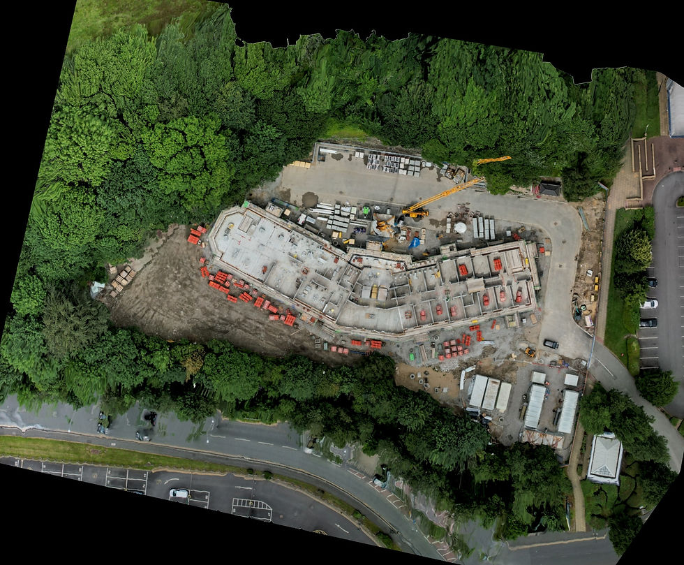
Aerial Devolopment - Construction Site
This series of aerial images and orthophoto mapping captures an ongoing construction development site, recorded using the DJI Air 2S to provide a clear, up-to-date visual record of progress.
Shot from multiple viewpoints, the imagery documents the evolving site layout, including building foundations, structural works, access routes, material storage areas, and surrounding infrastructure. The orthophoto provides a precise, top-down, true-to-scale overview of the site, making it ideal for monitoring progress, planning, and stakeholder reporting.
Together, the aerial photography and orthomosaic deliver a comprehensive snapshot of the development at its current stage — offering clear insight into site organisation, scale, and progress that ground-level photography alone cannot provide.